
South Bend ZIP Coverage
The official St. Joseph County map gives area orientation, while USPS remains the authority for a delivery address. The county copy was updated in October 2025. Its polygons are useful for seeing broad relationships, but they cannot decide a disputed mailing label. This South Bend ZIP code directory keeps geographic codes apart from additional special or institutional codes.
| ZIP | Area shown | Postal point | Use note |
|---|---|---|---|
| 46601 | Central and downtown | South Bend Main | Geographic ZIP |
| 46613 | South and southwest | South Bend operation | Geographic ZIP |
| 46614 | South, east, southern county edge | Chippewa | Nearby rural delivery may share label |
| 46615 | East and southeast | Edison Park | Geographic ZIP |
| 46616 | West and central-west | South Bend operation | Geographic ZIP |
| 46617 | North-central | South Bend operation | Geographic ZIP |
| 46619 | West and southwest | Olive Street | Geographic ZIP |
| 46628 | West and northwest | South Bend operation | Geographic ZIP |
| 46635 | East and southeast | Edison Park area | Verify each address |
| 46637 | North and northeast, university side | South Bend operation | Geographic ZIP |
| 46624, 46634, 46660, 46680, 46699 | Not separate county-map polygons | SOUTH BEND label | Treat as special until USPS confirms class |
Nearby county ZIP areas include postal cities outside South Bend. Do not silently count those as city ZIPs. A facility serving a delivery point may also differ from the five-digit labeling city.
Verify a South Bend ZIP
USPS offers two distinct routes. Its by-address form accepts street address, city, and state, then returns a ZIP or ZIP+4 when matched. The city-and-state route returns ZIPs associated with a postal city. A failed match can result from a new address, unit omission, rural route, format problem, or update timing.
| USPS field | Used for | Result |
|---|---|---|
| Street address | Delivery-point lookup | Matched five-digit ZIP and possible ZIP+4 |
| City | Postal city label | Helps validate the address |
| State | Required geographic context | Indiana match |
| City and state route | Postal-city overview | Associated ZIP list |
Use the USPS address lookup for one delivery point.
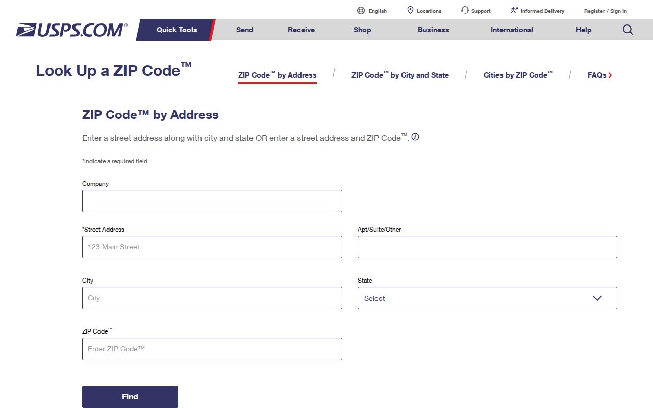
The form is the delivery check, not proof of who occupies the address.
Search South Bend by ZIP
A ZIP code directory narrows geography; it does not produce a resident roll. Use the smallest official source that answers the question. The county map supplies orientation, USPS validates delivery, GIS adds parcel and municipal context, and recorded land or tax systems answer their own ownership questions.
- Validate the full address through USPS and save the exact postal label.
- Check the county ZIP map to orient the address within St. Joseph County.
- Use county GIS to compare the parcel, city boundary, and other available layers.
- Open the proper custodian's record with an address, parcel, name, or case key.
- Move to the South Bend street directory only after narrowing to a named street.
The live county GIS and LowTaxInfo controls were not stable enough during research to certify every ZIP field label. Do not promise a ZIP filter that the active portal does not show. Address or parcel ID remains the documented GIS route.
South Bend Postal City Search
The city-and-state route answers a broader question than the address form. It lists ZIPs tied to the postal city name, including codes that may not form a normal neighborhood polygon. This is helpful for orientation and dangerous for inference. It cannot identify a street, parcel, precinct, owner, or household.
Open the USPS city and state search when only the postal city is known.
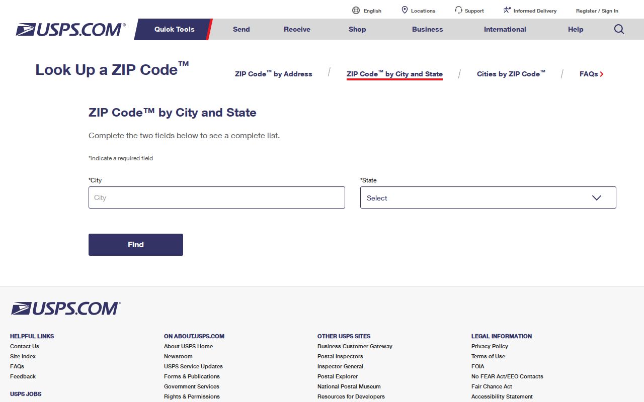
The returned list must still be narrowed with a full address before record research.
South Bend ZIP Boundary Limits
A South Bend mailing label can coexist with a different municipality, township, precinct, neighborhood, or parcel setting. South Bend and Mishawaka keep distinct city resources, while the county serves both and surrounding towns. Which office matters depends on the record, not the mailing city printed on an envelope.
- ZIP
- A five-digit postal delivery area or code.
- ZIP+4
- A delivery-specific extension that may narrow a route or point but is not a parcel ID.
- PO-box ZIP
- A code used for post-office-box delivery rather than a normal mapped neighborhood.
- Unique ZIP
- A code assigned to a high-volume institution or special recipient.
- Carrier route
- A postal delivery path, not a city or property boundary.
The county GIS and assessor describe land context. USPS describes delivery. Neighborhood plans describe community identity. Recorder and Auditor records describe recorded or tax history. Keeping each source in its lane prevents a broad ZIP match from becoming a false claim.
South Bend Parcel Address Layers
Apartment and suite details make these distinctions clear. USPS may need a unit for delivery, while GIS may display one parcel, a multifamily improvement, or a condominium legal description. A property card's situs address, its tax-mail address, and the deliverable address can differ. Situs means the location assigned to the parcel itself.
The county property and tax search illustrates why property context belongs beside, not inside, a postal result.
A property result can show a mailing ZIP outside the county without changing where the parcel sits.
South Bend Neighborhood Geography
River Park shows why community identity and postal geography must stay separate. The City's neighborhood plan gathers resident feedback around a named place, but that planning boundary is not a ZIP, ward, parcel, or official address boundary. Neighborhood associations and the Neighborhoods Consortium serve civic communication, not postal assignment.
| USPS | Delivery label and route |
|---|---|
| County GIS | Parcel and government boundary context |
| Recorder | Recorded land instruments |
| Neighborhood plan | Community identity and planning scope |
This comparison is the central geography lesson: all four sources can correctly describe the same place while answering different questions.
South Bend Before ZIP Codes
ZIP Codes began nationally in 1963. Nineteenth-century directories, early Sanborn sheets, old plats, and pre-1963 maps therefore cannot contain a modern code. Search those sources by the city, ward, township, street, and county terms printed at the time.
A modern ZIP may be added only as a clearly labeled cross-reference after the historical address has been reconciled. Never insert it into a transcription or imply that the old publisher used it. A changed street number can be a larger obstacle than the missing postal code, especially around South Bend's post-renumbering 1883 directory.
New address assignment is also outside a ZIP lookup. The applicable county Surveyor or municipality is the authority. Research did not verify one current public form for every road type, so contact the responsible office rather than treating a postal match as an official assignment.
Historical work should preserve every label from the source. Write down the publication year, city or town, ward or township, street spelling, house number, and county. If the street number changed, consult the city directory's own street index and compare cross streets, nearby firms, plats, and Sanborn sheets. Only after the old place is reconciled should a current parcel or South Bend ZIP code appear beside it. The modern value is a research aid, not part of the original record.
South Bend ZIP Access Channels
Online tools are the fastest route, but they are not the only route. USPS supplies the address and city-state lookups for delivery labels. The county ZIP page and downloadable October 2025 map provide local orientation. County GIS and the Assessment Neighborhood Map accept documented address or tax-ID searches for parcel context. If an interface fails, contact the responsible postal, assessor, GIS, Surveyor, or municipal office with the full address and the exact question.
Property and voter sources require special care. A tax mailing ZIP may belong to an owner or contact outside South Bend, while a situs ZIP describes the parcel's location label. IndianaVoters is designed to let a voter validate registration, polling place, ballot information, and county contact details. It is not a public ZIP-wide household list. The county Elections office is the fallback for a person's own registration question and for rules that govern election records. Address Confidentiality Program flags can also limit what appears.
When requesting an existing government record, the Indiana Access to Public Records Act requires reasonable particularity. Name the record, office, date range, and address or geographic field rather than asking an agency to create a new list of everyone in a ZIP. An in-person or phone request receives a response or acknowledgment within 24 hours; mail, email, or fax routes have seven calendar days. Those are response deadlines, not guaranteed production times. Inspection is generally free, while copies or certification may cost money.
Keep the response with the original ZIP question and access date.