
Walk a South Bend Street
A reliable South Bend street directory search begins with a place, not a list of names. The St. Joseph County GIS viewer can locate an address point or parcel, while the Assessment Neighborhood Map connects that parcel to a current annual property card. Those sources may show an owner or taxpayer, but neither proves who sleeps there now. Deeds document title events. Voter information has legal access limits. A dated directory can identify a historical subscriber or business. Keep each role and date attached to its source.
- Enter the full address in the county Assessment Neighborhood Map. Save the county tax ID and the date shown on the property card.
- Open the county GIS viewer. Confirm the parcel boundary, road, municipality, and adjacent lots rather than trusting a map pin alone.
- Use the official Indiana voter portal only for its intended self-lookup and civic functions. Ask County Elections about lawful voter-data access.
- Search the Recorder's Tapestry index by parcel or owner name. Read the deed image before treating an indexed name as a title holder.
- For a past household, consult a dated criss-cross volume or city directory through the library and record the publication year.
This address-to-parcel-to-instrument path makes the query repeatable. If one portal fails, the Assessor, GIS staff, Recorder counter, Archives, and library provide separate fallback routes.
South Bend Street Search Fields
The county map tools answer different address questions. The Assessment Neighborhood Map accepts an address or county tax ID. Its parcel popup can lead to PARCPRC, the annual property-record-card PDF. The MACOG guide also documents owner-name and parcel searches, plus map highlighting and report output. Save the layer name, map date, and parcel number because a screenshot with no source fields is weak evidence.
| Field or Control | Kind | Use |
|---|---|---|
| Street address | Text search | Locates an address point or parcel; test directional and suffix variants |
| County tax ID | Parcel key | Identifies one county parcel and supports the property-card route |
| Feature type | Selector | Distinguishes a parcel, address, or other mapped feature |
| Owner name | Optional text | Finds an owner field in MACOG tools, not a current occupant |
| Parcel and boundary layers | Map controls | Shows lot lines, municipal context, and adjoining parcels |
| PARCPRC | Popup action | Opens the annual property card when available |
| Print or highlight | Output action | Preserves a dated map or feature report |
The City's address-point service publishes Street_Address, Street_Number, Street_Name, ZIP, and GISID fields. Use them to normalize an address, then return to the parcel or Recorder source for ownership evidence.
South Bend Address Terms
Several labels can sit beside the same South Bend property. Keeping them separate prevents a mailing contact or map label from becoming an unsupported household claim.
- Parcel
- A mapped tract of land identified by a county tax or parcel number.
- Situs address
- The physical location used by the assessment system, which may differ from the tax mailing address.
- Plat
- A recorded map that sets out lots, blocks, streets, and subdivision boundaries.
- Criss-cross directory
- A dated publication arranged by street address or phone number rather than only by surname.
A deed legal description can control a property transfer even when the GIS uses a simpler street label. A South Bend mailing city can also coexist with a township or other municipal jurisdiction.
South Bend Street Record Channels
No single roll lists all people along a South Bend street. Each custodian records a narrower fact. The address method becomes useful when the search retains that limit and uses the parcel ID to connect compatible property sources.
| Record Set | Keeper | What It Shows | Access |
|---|---|---|---|
| Property card | St. Joseph County Assessor | Tax ID, owner or taxpayer, situs, legal lot, value, card date | Assessment map and Assessor office |
| GIS parcel map | County GIS and MACOG | Parcel geometry, roads, boundaries, address points, adjacent parcels | Public viewer, hub, or mapping request |
| Recorded instruments | St. Joseph County Recorder | Grantor, grantee, instrument, tract, subdivision, parcel | Tapestry, Laredo, limited search, public computer, mail or office request |
| Permit and code record | South Bend Accela or County Building | Addressed project, inspection, case status, and sometimes applicant | Online portal, office, or APRA request |
| Historical directory | SJCPL, State Library, archives | Dated occupant, subscriber, or business listing | Digital scan, library shelf, research request, or archive |
The St. Joseph County Recorder offers a limited-data free search, Laredo for frequent users, and Tapestry for occasional searches. Older books or microfilm may require a public-computer appointment, mail request, or help from the Recorder and Archives. The county says public-computer sessions require appointments and last one hour. That fallback matters because the county does not publish a dependable start year for its online index.
Other channels fill gaps without changing what a record means. County GIS accepts an online mapping request for a custom layer, historical map, or data question that the public viewer cannot answer. A useful request names the location, wanted layer, date range, and delivery format. The Recorder can retrieve an instrument when given its number and recording date. South Bend and county permit offices can answer for an existing address file, while the Indiana Access to Public Records Act provides a route for a reasonably particular request. The law does not require an office to create a new street roster or answer a research question.
South Bend Streets in Permit Files
An address may appear in South Bend's Accela permit and code interface or in St. Joseph County Building records. These systems can date construction, repair, inspection, or a code case. They do not supply a complete household list. Search the exact number and normalized street name, note whether the property lies within City jurisdiction, and preserve the project or case date.
The South Bend permit and code case portal shows how municipal records are keyed to an address.
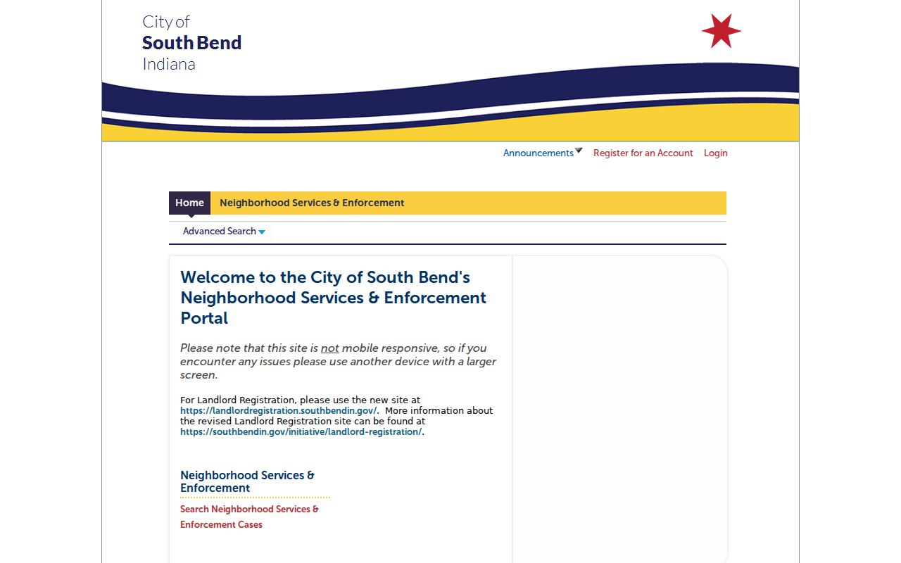
The screen is a route to an addressed event, not proof that the applicant, owner, and current occupant are the same person.
For parcels under county jurisdiction, use the St. Joseph County permits page and the Building Department. If the online interface does not expose the needed record, ask the office for the existing permit or submit a focused Indiana Access to Public Records Act request.
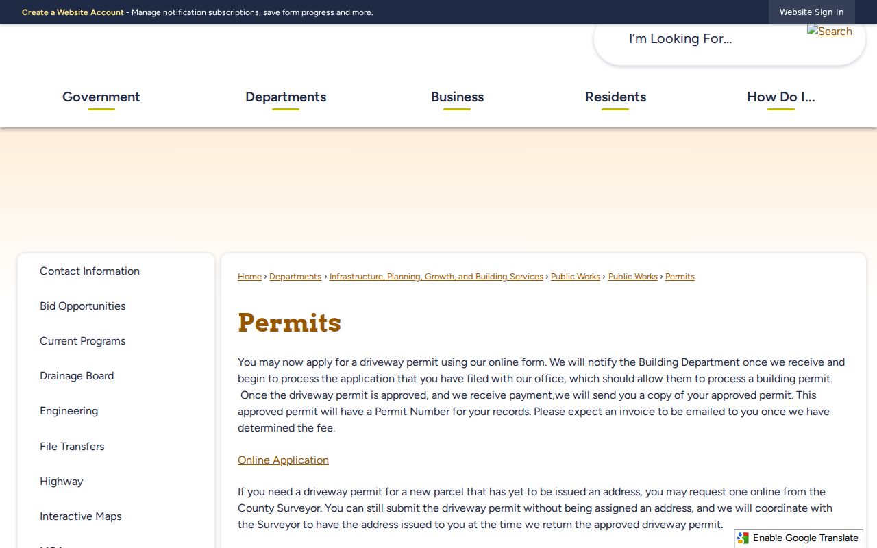
This county route is especially important when a postal address says South Bend but the GIS municipal layer places the parcel beyond City limits.
South Bend Streets Cross Jurisdictions
South Bend is the county seat, but the mailing city is not a legal boundary. St. Joseph County includes two cities, seven towns, and thirteen townships. Check the county GIS municipal layer before choosing the City permit portal, county Building Department, police agency, or zoning map. Some county interactive maps explicitly exclude South Bend or Mishawaka city zoning.
County road history adds another local clue. East and west numbered roads use the 200 to 290 range, while north and south roads use the 100 to 196 range. A road can also have a local name, county number, former name, or subdivision-plat label. That geography helps explain why an address hit may appear under a variant while still referring to the same route.
USPS delivery geography adds one more label, but it does not settle parcel or civic jurisdiction. A ZIP code can cross city or township lines. A neighborhood plan can describe community identity without changing the deed, situs address, precinct, or postal city. For any disputed location, retain all four labels and cite the agency behind each one.
South Bend Street Numbers Changed
The 1883 South Bend directory was issued after the city changed its address-number system. That fact turns an old address into a year-specific clue. When an earlier number fails in modern GIS, compare the street index in the directory, the deed or plat legal description, a Sanborn map, and nearby cross streets. The 1867 directory preserved by the Indiana State Library provides a useful pre-renumbering comparison.
A modern South Bend street directory should never silently convert the old number. Record the spelling, number, source year, and the evidence that links it to a present parcel. For more on the historical volumes themselves, use the South Bend city directory collections.
Deeds Along South Bend Streets
Once the tax ID is known, the Recorder index can connect a parcel to recorded title events. Tapestry accepts first and last name, date range, consideration, document number, document type, tract, subdivision, and parcel number. A search costs $8.75. Images cost $1.50 for the first page and $1.25 for each later page. The Recorder remains the source for an official or certified copy.
Read grantor as the party conveying an interest and grantee as the party receiving it. A mortgage, release, lien, easement, or power of attorney may be indexed to the parcel without changing ownership. Recent Recorder, Auditor, and Assessor results can also disagree because the Auditor notes a 24-hour portal delay, deed transfers may take one to three days, and property cards update annually.
For ambiguous names, narrow the index with the parcel, tract, subdivision, document type, and date. Trusts, business entities, married names, initials, and spelling changes can break a simple name search. Stop when the legal description no longer matches. Choosing a plausible name creates a false owner chain and weakens every later address conclusion.
Browse South Bend by Street
To study a whole block, begin with one verified address and click adjoining parcels. Note corner lots, alleys, subdivisions, parcel IDs, map date, and municipal boundaries. Repeated name searches can miss a parcel held by a trust or business and may merge people with similar names. Map navigation keeps the work tied to land.
The result should remain a source log, not a compiled roster. List owner-of-record, taxpayer, permit applicant, directory occupant, and voter-related civic geography in separate fields. If the goal narrows to one modern person, the South Bend resident lookup workflow shows how to verify that name without turning a whole street into a profile list.
South Bend Street Directory Limits
An assessor card can name an owner or taxpayer while a deed records parties to an instrument. Neither source proves every current occupant. A voter self-lookup has a narrow civic purpose, and Indiana restricts voter-file use. BMV personal address records are protected by the Driver Privacy Protection Act. Protected voters may also use Indiana's Address Confidentiality Program, which supplies eligible survivors with a substitute address.
Commercial neighbor-search products often blend old and current material with no clear date. Official sources are narrower, but they identify the custodian, role, and record date. A sound address result states what the record proves and leaves out sensitive household details that the source does not establish.
Lawful use. Use South Bend address records for lawful personal, civic, or historical research. Never use them to stalk, harass, intimidate, or harm anyone.
When a record looks wrong, return to the office that keeps it. The Assessor can explain a property card, GIS staff can identify a layer, the Recorder can supply an instrument, and the City or county records officer can answer a request for an existing permit file.